Template:Indian States Image Map

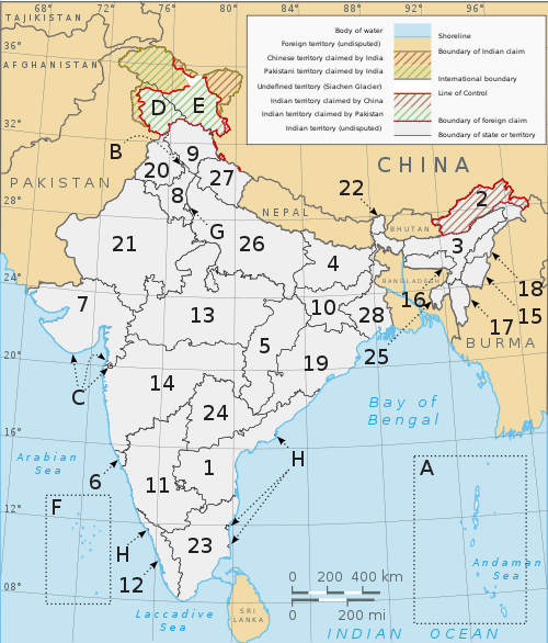
A clickable map of the 28 states and 7 union territories of India.
A clickable map of Indian states and territories.Indian OceanBay of BengalAndaman SeaArabian SeaLaccadive SeaSiachen GlacierAndaman and Nicobar IslandsChandigarhDadra and Nagar HaveliDaman and DiuDelhiLakshadweepPondicherryPondicherryPondicherryAndhra PradeshArunachal PradeshAssamBiharChhattisgarhGoaGujaratHaryanaHimachal PradeshJammu and KashmirJharkhandKarnatakaKeralaMadhya PradeshMaharashtraManipurMeghalayaMizoramNagalandOrissaPunjabRajasthanSikkimTamil NaduTripuraUttar PradeshUttarakhandWest BengalAfghanistanBangladeshBhutanBurmaChinaNepalPakistanSri LankaTajikistanDadra and Nagar HaveliDaman and DiuPondicherryPondicherryPondicherryPondicherryAndhra PradeshGoaGujaratJammu and KashmirKarnatakaKeralaMadhya PradeshMaharashtraRajasthanTamil NaduPakistanSri LankaSri LankaSri LankaSri LankaSri LankaSri LankaSri LankaSri LankaSri Lanka
A clickable map of Indian states and territories.